

SELECTED WORK / PRODUCTION
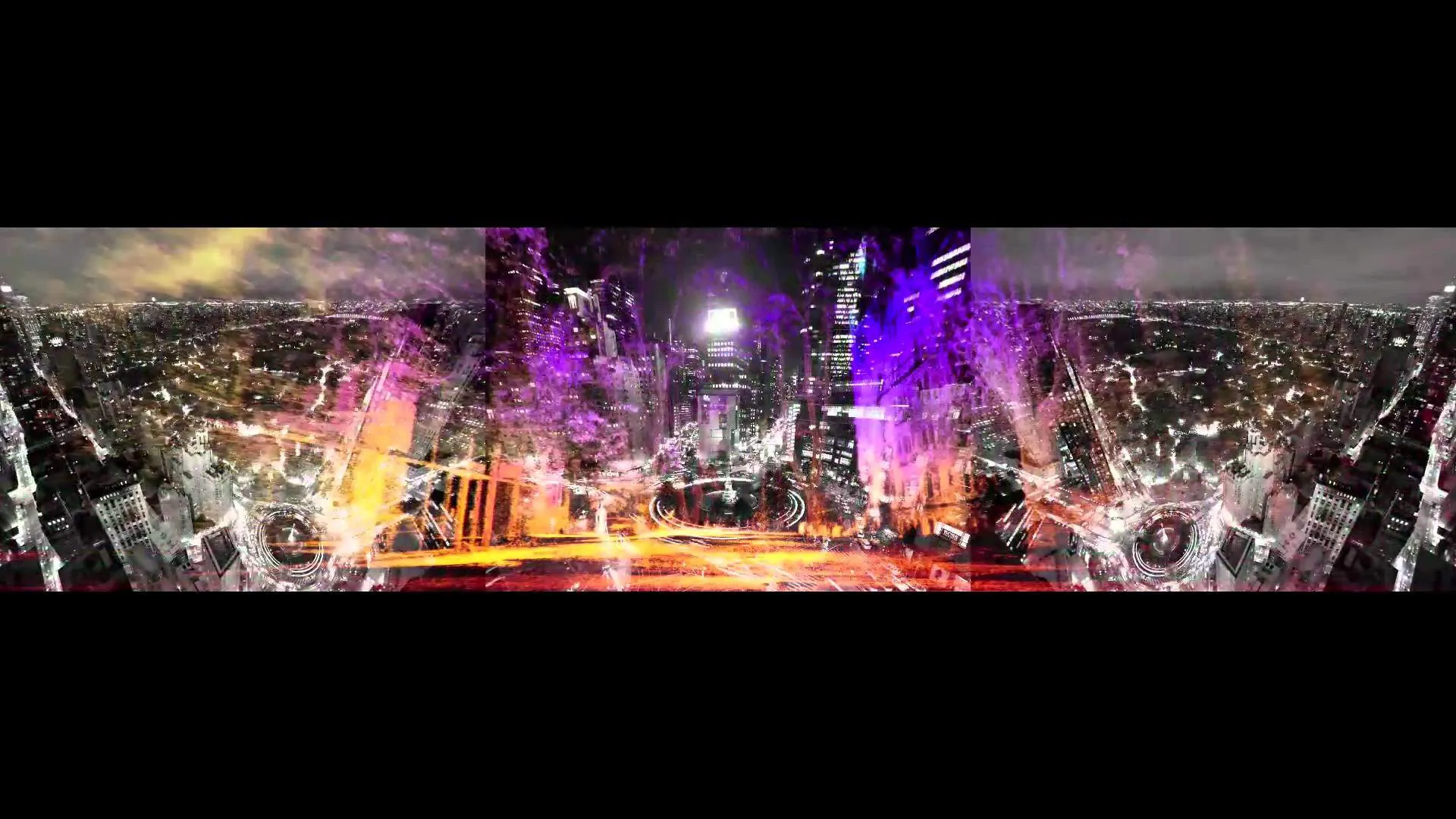
Hugo Boss: Anthropocene
- Studio
- Mill+
- Released
- September 23, 2013
- SCANable role
- LiDAR Scanning/Concept/Creative Direction
- Director
- Marco Brambilla
- VFX vendor
- The Mill
“Anthropocene” is a triptych of haunting, dreamlike video installations by video artist Marco Brambilla and Mill+, created for the opening of the Hugo Boss flagship store at The Shops at Columbus Circle in New York City. Depicting the geography between Central Park and Columbus Circle, the piece merges LiDAR-derived imagery with black-and-white footage shot on the rare RED Epic Monochrome camera — with bird’s-eye views of Central Park secured with help from The Central Park Conservancy — all set to Camille Saint-Saëns’ Carnival of the Animals. The Mill’s 3D team, led by Head of CG Vince Baertsoen, mixed the scan data with programming and CGI to merge abstraction and realism into a surreal environment.
SCANable performed the acquisition of all on-set LiDAR for the project and contributed concept and creative direction, capturing the point-cloud data at the heart of the installation’s hyperreal digital landscapes.
When the point cloud is the image
Most of the time a scan is scaffolding. The measurement supports something else — a model, a track, a matte — and the data itself never reaches the screen.
Occasionally the data is the artwork. Raw points have a particular look: density that falls away with distance, voids where the beam never reached, a rendering of the world made of discrete samples rather than continuous surface.
That aesthetic resists imitation, because the pattern of what a scanner sees and misses is a property of where it stood. Capturing with the final image in mind changes how positions are chosen — coverage becomes a compositional decision as much as a technical one.
Above the tripod line
A tripod-mounted scanner sees what is in line of sight from ground level. Rooflines, tree canopy, and the shape of a large park from above sit outside its reach.
Aerial photogrammetry picks up from there, reconstructing the overhead half of an environment from imagery and tying it into the same coordinate space as the ground survey.
Most large exteriors need both. The seam between them is exactly where careless registration announces itself, so the two are planned together rather than captured separately and reconciled afterwards.
Cities do not hold still
An urban capture carries variables a stage never does: pedestrians walking through the beam, traffic, wind moving vegetation, and light changing across the hours a survey takes.
Some of that is filtered in processing. Most of it is handled at capture time, by planning positions and timing so that transient objects are never the only source of coverage for a surface that matters.
The result is a survey of the permanent city with the temporary city removed — which is what set and location scanning has to deliver whether the output is a matte painting or a gallery installation.
See more environment and point-cloud projects, or the full service list.
SELECTED WORK / GALLERY