

SELECTED WORK / PRODUCTION
Philips “Innovation Celebration” in Washington, D.C.
- Studio
- Philips
- Released
- March 11, 2014
- SCANable role
- LiDAR & 3D Modeling
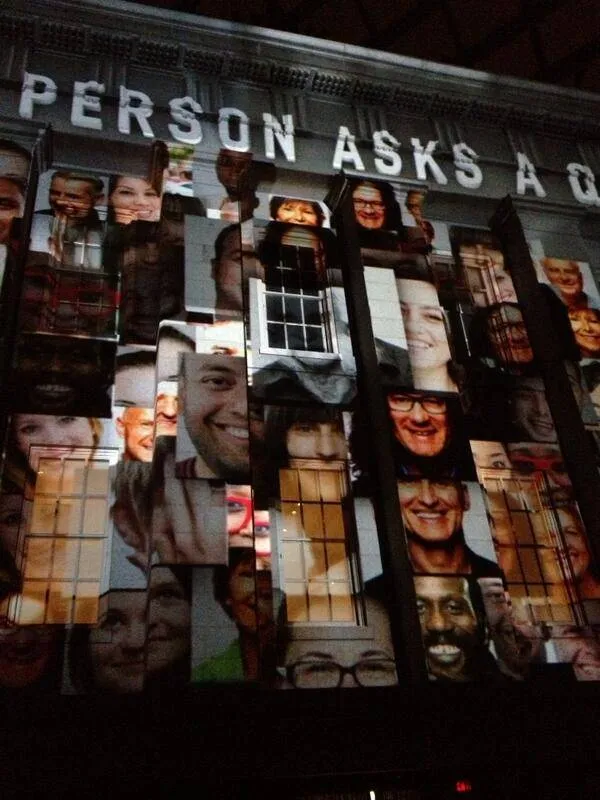
Philips’ ‘Innovation Celebration’ was a 2014 brand relaunch event at the National Portrait Gallery in Washington, D.C. Through a vibrant light show designed by world-renowned lighting and production designer Marc Brickman — who in late 2012 made history programming the Empire State Building’s first light show, with lighting by Philips and music by Alicia Keys — guests experienced Philips solutions to challenges in health care, energy efficiency, and well-being as the museum’s interior courtyard came alive with light played against its architecture.
In December 2013, Brickman tasked award-winning video system design and integration firm Pixel Density Design and SCANable with bringing his vision to life. SCANable used the latest terrestrial laser scanning technology to capture high-resolution LiDAR data of the National Portrait Gallery courtyard and built an accurate, detailed 3D model that Brickman’s team used to conceptualize and render an immersive experience projected back onto the space at the live event.
Projection mapping is a measurement problem first
Content projected onto architecture only sits correctly if the digital model and the physical structure agree to a very small tolerance.
A cornice that is off by a few centimeters in the model shows up on the night as light spilling past an edge, or as an image that skews as it crosses a plane. There is no fixing it in the room with an audience standing in it.
So the model has to come from measurement rather than from drawings. Laser scanning records a space as it was actually built — including every deviation from the plans — in one real-world coordinate space that projector positions and content can both be referenced against.
Measuring a protected interior without touching it
A historic building sets its own conditions. Nothing can be mounted to the fabric, nothing can be marked, and access is limited to hours when the space is not open to the public.
Laser scanning suits those constraints because it is non-contact and fast. Positions are planned for line-of-sight coverage of a complex volume, and registration ties them into one continuous survey.
The discipline that serves visual effects serves enterprise survey and heritage documentation equally well: the deliverable is a dimensionally honest record of a space that cannot be altered to make capture easier.
The model outlives the event
A live event runs for a night. The data behind it does not have to.
An accurate point cloud, and the model derived from it, stay useful long after the projectors are struck — for planning the next installation, for documenting the building’s condition on a given date, or for a later production that needs the space and cannot get in to measure it again.
That archival value is the quiet argument for scanning properly the first time. Our set and location scanning and modeling work is built to be revisited years later.
See more architectural and environment capture in the portfolio.
SELECTED WORK / GALLERY